
Sources for Manteca Previous Residents
Each source covers a different time layer. Start with the current parcel, then choose the oldest source that can answer the next gap. The dates below are verified local reach, not a promise that every year or image is available online.
| Source | Years it covers | Where held | What it shows |
|---|---|---|---|
| Recorder web index | January 1, 1968 to present | San Joaquin Recorder portal | Party names, instruments, title events, legal-description clues |
| Recorder office books, film, and maps | 1851 to present, as advertised | Suite 260, Stockton | Older deeds, maps, images, and counter research |
| Assessor and GIS | Current roll; historical depth not officially stated | County property and parcel systems | Present APN, situs, mailing distinction, parcel shape |
| Manteca permits | Reliable electronic coverage January 1, 2015 to present | Accela and Development Services | Construction and alteration chronology |
| City and reverse directories | Verified consulted years 1968 through 2020, with gaps | Library, report, and underlying publishers | Published household or street entries |
| Federal census | Public through 1950 | NARA, FamilySearch, library databases | Household and enumeration-date context |
| Sanborn maps | Exact Manteca sheets and years not confirmed | Library or archive inquiry | Possible footprint, use, and street-number context |
The gap is part of the result. A missing 1990s directory or an early deed image that is not online should be reported as an access limit, not silently filled with an assumption.
Manteca Previous Residents Start with Parcel
Normalize the current street address and use the San Joaquin property-information portal with Address, Assessment number, or Fee Parcel number. Save the APN, owner or assessee, situs, mailing destination, legal description, parcel status, and value-roll year. Then open the county GIS map, select the parcel, and note the adjacent polygons and city-limit layer.
The APN is a working handle, not the whole chain. A subdivision, lot split, merger, or boundary change can make a current parcel number a dead end. The legal description, lot and block, plat reference, and instrument number can carry the past-residents search farther back.
A mailing address can belong to an agent, entity, post office box, or a different property. It is a clue about the owner record, not a move-in date. Keep the address fields separate in the research notes.
That parcel-first start gives a Manteca previous residents search a stable question: which recorded land unit is being traced?
Manteca Deed Chain Backward
The Recorder's web party index reaches from January 1, 1968 to the present. It begins with an I Accept notice and describes the index as a card-catalog-like guide. Search the current owner's name, find the acquisition instrument, and capture its grantor, grantee, recording date, document type, instrument number, book and page when used, APN, legal description, page count, and image or copy route.
- Use the current parcel owner or assessee to locate the most recent acquisition instrument.
- Write down the seller or grantor and the legal-description wording, not just the street number.
- Search that seller as an earlier grantee and compare the recording date and parcel clues.
- Repeat the seller-to-prior-buyer step until the online index stops or the title path changes.
- Carry book, page, party names, and legal description to Suite 260 for pre-1968 books, film, maps, or certified copies.
A grantor transfers an interest. A grantee receives it. A chain of title is the connected sequence of recorded transfers. A legal description defines the land in words, while an APN is an assessor identifier. These terms matter because the street address can change while the recorded land description remains recognizable.
Recorder self-assisted copies are listed at $1 per page, staff-assisted copies at $3 per page, certification at $2 per document, and recorded-map copies at $5. Use the live Recorder page for current fees and counter instructions.
Manteca Previous Resident Parcels
The most useful insider tip in a Manteca previous residents search is to preserve every APN and legal-description change. Current-APN searching can fail after a split or merger even when the deed trail continues. Compare the lot, block, subdivision, book, page, and instrument references. A plat can connect a historical land label to a later street system.
Keep both keys. Use the APN for the present parcel search and the legal description for continuity. Never discard an older identifier just because the current assessor card uses a new one.
Manteca's early residents may be indexed under Cowell Station, rural routes, township and range, ranches, or county geography. A modern street name can be a late label. Search the place variants and neighboring households when a deed or directory appears to vanish.
Note: The Recorder's 1851 research reach and the web index's 1968 cutoff answer different access questions.
Manteca Past Households in Directories
A deed chain follows owners. To find previous residents, add a household layer. The verified local directory ladder includes Polk in 1968, Haines Criss-Cross in 1971, 1974, 1977, 1981, and 1985, directory evidence in 1992, 1995, and 2000, Cole in 2005, 2010, 2014, and 2017, and EDR Digital Archive in 2020. Cataloged Polk Manteca editions also include 1970, 1976, 1978, 1979, 1981, and 1983. Earlier countywide volumes have Manteca sections in 1913, 1924, and 1937.
Ask the Stockton-San Joaquin County Public Library whether a reverse or criss-cross volume is held, and whether it is on the shelf, on microfilm, or reference-only. Search the name section, then the street section. Pair a directory year with the closest federal census through 1950. Census geography shifts, so track township, enumeration district, and nearby households rather than relying only on Manteca as a city label.
Newspapers and obituaries can bridge a gap. They may show a death, marriage, school event, club role, legal notice, or address clue. Probate can identify interested parties in an estate. Each remains a clue until checked against the custodian record.
The Manteca city directory collections page carries the shelf details; this past-residents page keeps the focus on the backward address trail.
House-history boundary. A published entry can document a name at a place in a year. It does not prove every person at the address or a precise move date.
Manteca Permit Records Date Changes
Manteca Accela Citizen Access is reliable for electronic permit coverage from January 1, 2015. Anonymous users may view existing records. Free registration adds application history, invoices, and receipts. Building, planning, and public-works modules can expose a project description, permit contacts, licensed professional, expiration, review status, and inspection history.
Those fields can show when a house changed, when an inspection occurred, or when a project was reviewed. An applicant or contractor is not automatically an owner or resident. Older permits and some planning applications may require Development Services counter research at 1215 W. Center St., Suite 201. Building Safety uses (209) 456-8550 and MantecaPermits@manteca.gov.
For a city document not already posted, send a focused California Public Records Act request to the City Clerk. Name the address or parcel, department, record type, and date window. A municipal permit chronology can fill a physical-house gap without pretending to supply a household list.
Manteca Business Records in a Title Trail
A historical address can appear in a business filing or financing record without representing a household. The California Secretary of State's UCC search supports debtor, file-number, and secured-party routes. A standard debtor-name inquiry is listed at $5; a wildcard or non-standard inquiry is free; file-number and secured-party inquiries are $5; document images are $1; and an online debtor-search certificate is $5.
UCC filings can help explain a business or secured transaction linked to a name. They are not a substitute for a real-property deed. Electronic copies of pre-2008 filings have Social Security numbers removed, and current paper submissions are redacted for electronic display.
Open the SOS UCC search when the name or address trail points to a business filing.
The UCC screen shows a separate business-record lane. Keep its filing number and debtor role distinct from a deed instrument.
Archive Fallbacks for Manteca Previous Residents
The California State Archives and State Library can fill historical-index gaps when the county web portal ends. The Stockton-San Joaquin County Public Library and San Joaquin County Historical Society add local newspapers, photographs, organization material, directories, and family context. FamilySearch may hold images of deeds, probate, vital, and church material that are available only through a center or affiliate library.
Research did not confirm exact Manteca Sanborn sheets or years, a complete printed-directory run, a defined courthouse-fire loss, or an official street-renumbering year. Those gaps belong in the research log. Ask a librarian or archivist to verify an item before treating it as a bridge between two deeds.
Open the California State Archives and the California History collection for catalog and reference routes.
A local history source can explain a place name, employer, organization, or street context. It still needs a date and a record type before joining a previous-residents timeline.
Manteca Previous Resident Name Clues
The State Controller's unclaimed-property search can provide a last-known reported address clue, property ID, and reporting-holder information. It accepts a last or business name or a property ID, with first name, city, and ZIP as optional fields. Exact matches appear before similar names. Claims are free, but proof is required, and claims of at least $1,000 plus securities and safe-deposit claims require notarization.
This source can suggest a next archive or newspaper search for previous residents. It cannot establish that a person occupied an address in a certain year. Confirm the name and address with a directory, deed, probate, obituary, or vital record where access rules permit.
Open the California unclaimed-property search only as a lead source.
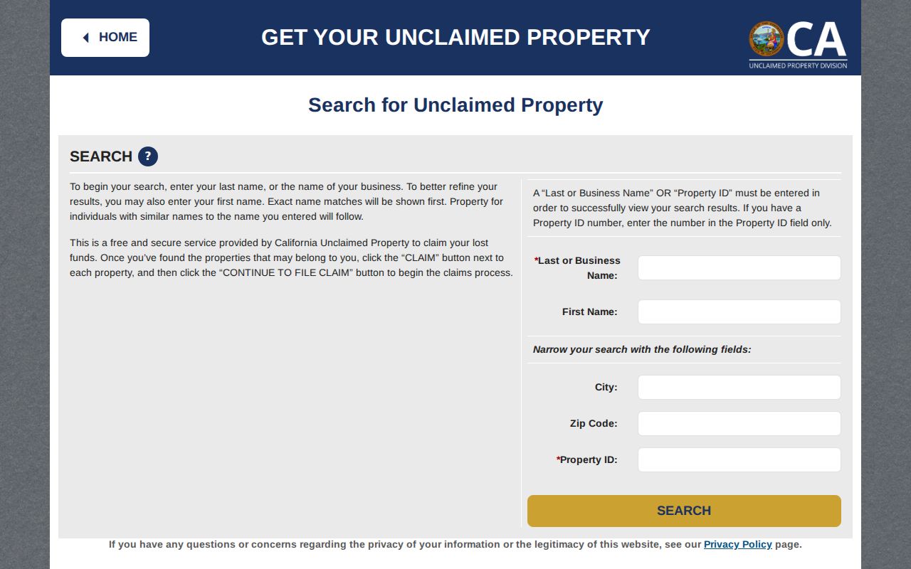
The State Controller result is a reported-address clue, not a past-resident roster.
What Manteca Previous Residents Records Prove
A recorded transfer does not show move-in or move-out dates. A directory can omit a person. A census captures one enumeration date. A permit records a project. A mailing address can be an agent or another property. A protected person may use Safe at Home. These limits are not defects to hide; they are the reason a past-residents timeline needs source labels.
Use the current parcel as the starting point, the deed chain as the ownership spine, directories and census schedules as household snapshots, permits as physical-change dates, and probate or newspapers as event clues. The Manteca by-street workflow handles current parcel and address records; the historical directory collections provide the publication detail.
Lawful personal use. House history can support genealogy, property research, and lawful reconnection. Do not use past-resident information to stalk, harass, intimidate, or harm anyone.
When the chain stops, name the exact stop: web cutoff, missing image, unverified shelf year, restricted file, or unresolved same-name result. A precise gap is more useful than a guessed resident.